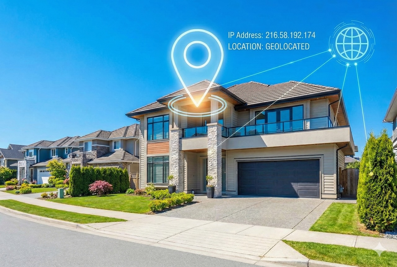
It is estimated that only 1% of the world’s habitable land is considered urban. Rural areas account for most of the world's land area and host 40-43% of the global population, according to Phys.org. These areas present a unique set of challenges due to a low local population and geographic isolation. The digital divide is one of the biggest hurdles for rural development, making it difficult to undertake rural property assessment. Specifically, internet protocol (IP) addresses are often viewed as digital footprints that help verify a property’s location. Unfortunately, these can become traps for inaccurate valuations.
Geolocation Intelligence
Technology advancements have made it possible to pinpoint the exact location of a property and establish its boundaries accurately. The use of aerial imagery and geolocation intelligence is much more effective and accurate regardless of internet service provider (ISP) routing. Mapping an IP address to a physical location works best in densely populated urban areas where ISPs have granular infrastructure. This means that providers design and manage their networks with very precise levels of control, segmentation, and visibility tracking down users, devices, and services.
In contrast, rural regions often route traffic through a regional hub. For example, an individual sitting on a farm in rural Nebraska might have an IP address that is 300 miles away. In addition, most rural residents utilize dynamic IP addresses that often change. A location that was accurate last week may be assigned to a different town the next month and so on. This ambivalence makes it difficult to generate exact coordinates for a property in rural settings. Additionally, numerous remote real estate properties rely on satellite internet services, such as those provided by Starlink or Viasat. These signals bounce from space and back to the ground station often reflecting the location of the station which could be in a different region rather than the property.
IP Addresses Are Not Maps
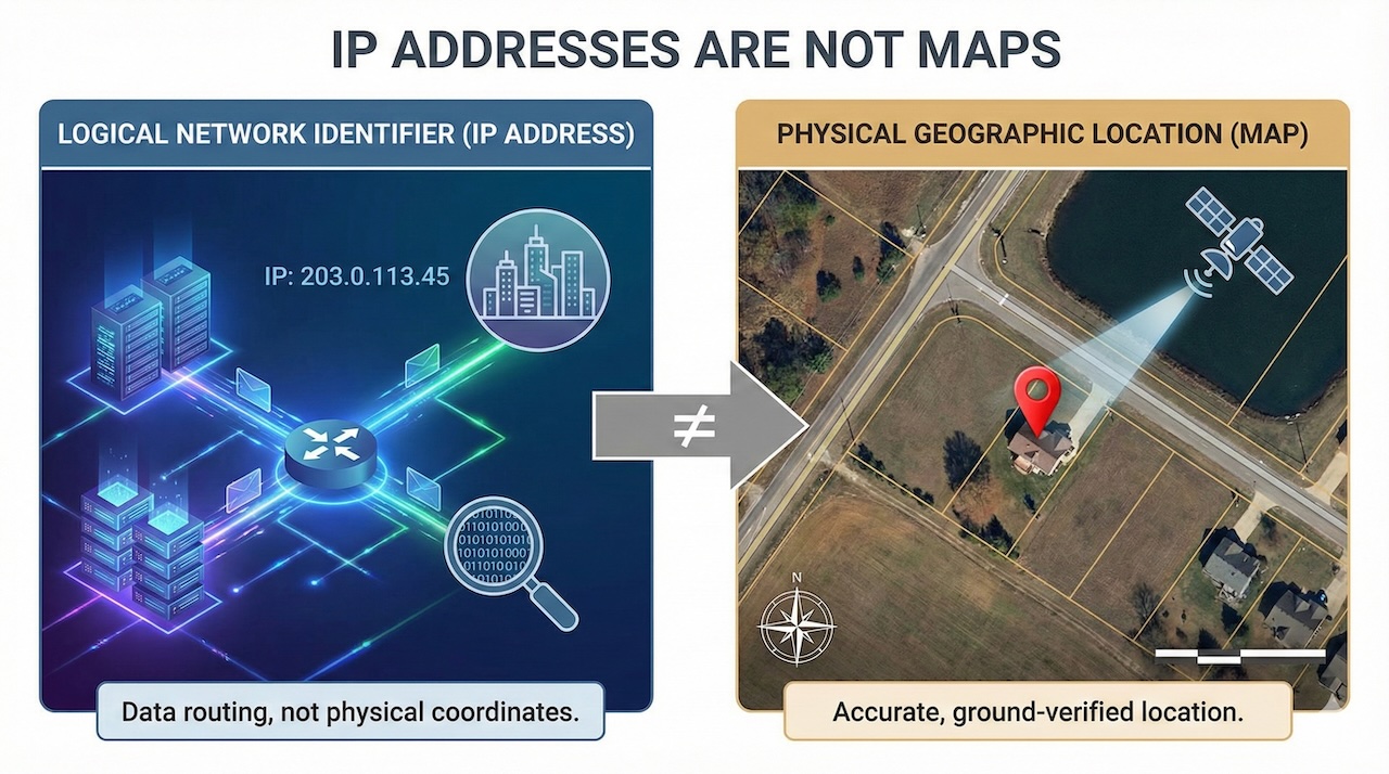
In property assessment, IP addresses are hardly used to find the land. Instead, they are used as tools for verification and audit trails. It is particularly useful in verifying field work. For instance, the IP address of an appraiser is captured upon submission of a digital valuation from the field. If it is traced to another country or a known virtual private network (VPN), the assessment is flagged as potentially fraudulent. This is known as couch appraising, that, the practice of valuing a property without visiting it.
On the other hand, a legitimate appraiser might be identified as suspicious simply because their mobile hotspot is routed through a distant tower. This also creates administrative problems and frictions. Hence, to ensure accuracy in rural areas, assessment companies and local governments should stay away from IP-based location and use global navigation satellite systems (GNSS) to provide raw coordinates, cadastral overlays to link physical structures to legal tax parcels, offline geofencing using pre-downloaded maps to capture data where IP is absent, and use of plus codes or short digital address to provide a street address for properties that don’t have one.
Rural Assessment and Automated Systems
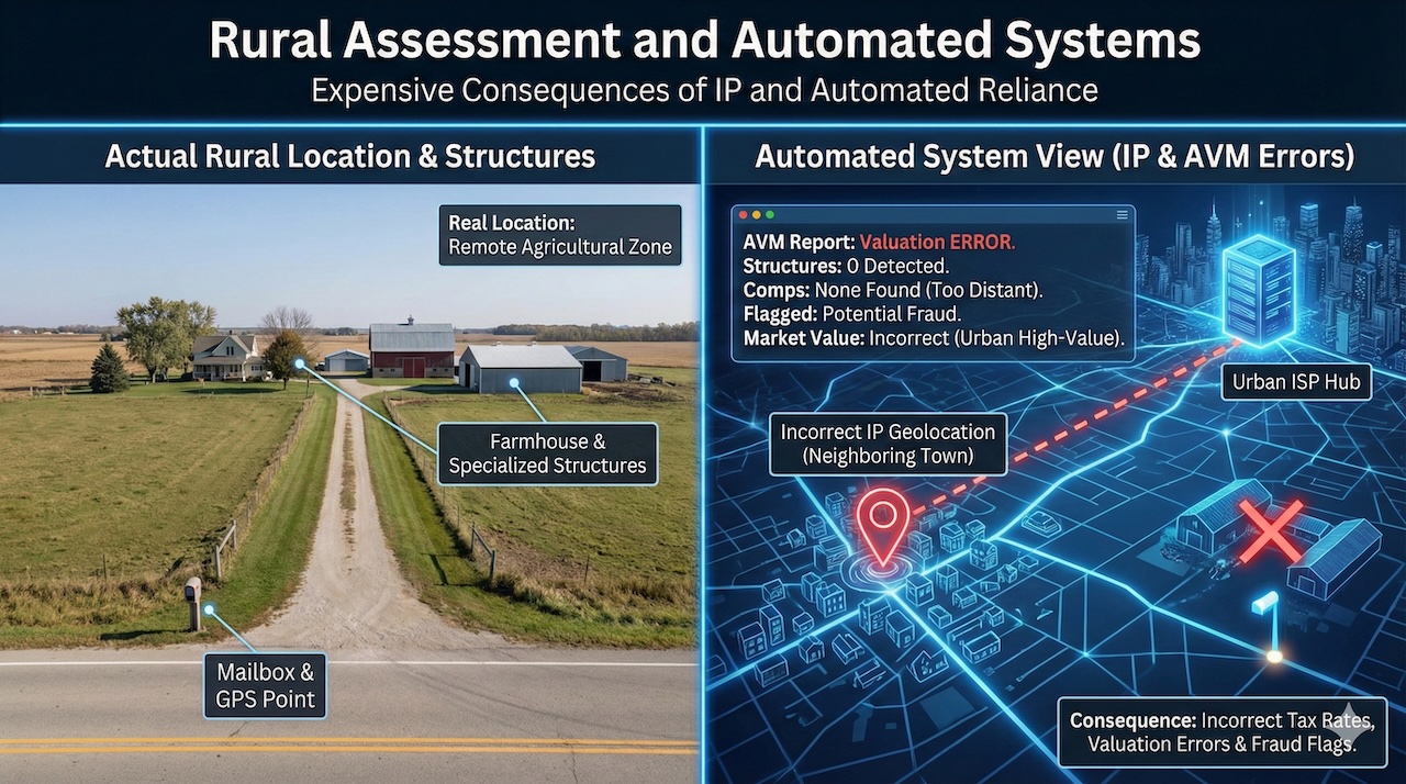
Reliance on IP-based data for rural property assessment can have expensive consequences. For example, a property may be erroneously placed in a neighboring town that has different tax rates. A rural ISP may direct all traffic from a town through a single server in a major urban area just a few hours away. The result is that the automated system views the property as being in a high-value city rather than a remote agricultural zone. This also triggers incorrect market value or flags a legitimate local assessment as fraud. Automated valuation models (AVMs) depend on a single global positioning system (GPS) point or geocode to identify a property. Unfortunately, in a rural setting, geocodes are often placed at the mailbox on the main road though the actual farmhouse and other buildings might be farther down a private drive. Moreover, automated systems may recognize standard roof lines in urban centers but in rural environments, they often miss specialized agricultural structures. ‘Market comps’ may have hundreds of urban samples for comparison. But this is not the case in rural environments where the nearest neighbor might be miles away in a different territory. Infrastructure planning may utilize assessment data that groups properties near ISP hubs rather than their actual remote site. These errors can affect valuation of real estate.
Conclusion
The bottom line is an IP address tells where the data packet came from but not the exact location of a property. Hence, the physical coordinates of the soil reflect its true position which ensures fair taxation and helps investors make informed decisions.
Featured Image generated by Google Gemini.
Share this post
Leave a comment
All comments are moderated. Spammy and bot submitted comments are deleted. Please submit the comments that are helpful to others, and we'll approve your comments. A comment that includes outbound link will only be approved if the content is relevant to the topic, and has some value to our readers.
Comments (0)
No comment