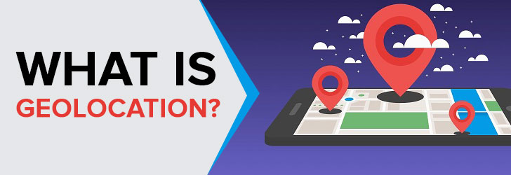
What is HTML Geolocation
HTML5 takes advantage of geolocation by building an API within the HTML language. As Hypertext Markup Language (HTML) evolved over time and reached HTML5, the focus shifted toward adding modern functionality to enable more creative use of the language. Geolocation's addition to this suite allows developers to query a smart device's location via the API and effectively map a person. As this feature raises privacy concerns, it is limited to requiring users to grant their browser permission to use HTML5's API to share their location. On top of that, the Chrome browser, in particular, went a step further and ensured that only websites that are HTTP-Secured can make use of the API.
What is Cellular Geolocation
Cellular geolocation is performed through a series of pings with the nearest cell tower that your cellular phone is connected to. Because of this, the accuracy of this information is not as granular or as high as that of IP-Geolocation or HTML Geolocation. This method was developed through the Global System for Mobile Communications (GSM) and Code-Division Multiple Access (CDMA) standards to help with the location of such devices.
What is IP-Geolocation
IP-Geolocation is the process of mapping a smart device to its IP Address. This means that as long as the device has connected to the Internet in some way and holds an IP Address, it can be physically placed on a map. The only limitation is that the device in question can connect to the Internet; virtually everything in today's world can be located through geolocation in one way or another. Using this, one can find a device's longitude and latitude and plot its location on a map. The accuracy of IP-based geolocation is accurate to the city level, while GPS provides accuracy to a meter.
IP-Geolocation Databases
Geolocation databases function as the underlying bedrock for geolocation to exist in the modern world, and while the accuracy of the coordinates may vary from database to database, it usually depends on the level of granularity of the information. Nevertheless, some of the more common databases in use for commercial uses are Ip2location, DB-IP, IPinfo, and MaxMind.
With most, if not all of these databases, an API is offered as well for developers to be able to communicate with these databases and use the information they offer. One very notable API is the W3C Geolocation API, made by the World Wide Web Consortium. This API's goal was to standardize a method for gathering geographic data, which gave rise to many modern technologies for collecting this information.
What is Geocoding
Geocoding is a process deeply tied to geolocation. In its simplest form, IP-geolocation is the plotting of a smart device on a map, while geocoding is the means of gathering a device's coordinates through other means; that device's geographical data. The geographical data used pertains to a device's city, address, and other such information, and is then stored in Geographic Information Systems (GIS). This information is stored and allows us to use reverse geocoding to derive a device's city, state, address, or other such geographical data from the device's coordinates. Basically, one should think of the GIS as a dictionary of sorts, which maps all possible coordinates to easy, human-readable text that makes sense to us, rather than to two numbers.
How Geolocation Works
At the core, geolocation is set up even before a device is issued an IP Address. The Internet Service Provider (ISP) provides an IP Address that has already been stored in a database based on that ISP's location. This database, such as ARIN's Whois database, is a means of matching contact and registration information for all Internet Protocol (IP)- related data registered with the company, such as IP Addresses. What this basically means is that these database companies provide the necessary setup for geolocation to be successful.
Modern Applications
Technology has come a long way and is constantly evolving every day, and it's no exception with geolocation. Thanks to this, geolocation has found widespread, everyday use in today's world. RFID (radio frequency identification) tags have come about as a result of this and function as neat little devices that can be tagged to other items that have no means of connecting to the Internet. Through this, one can then geolocate these tags and their tagged objects.
Bluetooth MAC Address has also been able to be used to this end, particularly on smartphones in partnership with the WiFi Adapter. These two functions work together to improve the accuracy of the device's geolocation and provide databases with a higher level of granularity. GSM/CDMA, as well as GPS, have also been great benefactors of this technology, as they are able to consistently track your device or vehicle as it is moving. In some cases, the accuracy of these applications can be a bit off, but over time, their accuracy has most definitely improved, and as a result, these applications have become far more commonplace.
Conclusion
Geolocation has evolved into a foundational technology that powers many of the digital experiences people rely on every day. From HTML5’s permission-based browser tracking to cellular triangulation and IP-based mapping, each method offers a different balance of accuracy, accessibility, and privacy. While GPS delivers the highest precision, IP geolocation remains one of the most practical and widely used approaches due to its speed and ability to function without direct user input.
Behind the scenes, geolocation databases and geocoding systems work together to translate raw network and coordinate data into meaningful, human-readable location insights. These systems are continuously refined through advancements in data collection, infrastructure mapping, and standardization efforts such as the W3C Geolocation API.
As modern applications—from fraud detection and content personalization to logistics and asset tracking—continue to expand, geolocation will remain a critical component of the digital ecosystem. However, its use also requires careful consideration of privacy and accuracy limitations. Understanding how these technologies work enables developers, businesses, and users to make more informed decisions about when and how to rely on location data.
 FAQs
FAQs
IP-based geolocation refers to the process of mapping an IP address to a real-world geographic location. This typically includes identifying the country, region, city, latitude/longitude, Internet Service Provider (ISP), and sometimes domain or connection type.
It is important to note that IP geolocation does not track an exact physical address. Instead, it estimates the location based on data associated with the IP range assigned to an ISP or organization. While MAC addresses (MAC address) are used within local networks, they are generally not exposed over the internet and are not used in standard IP lookups.
There are several commercial providers offering IP geolocation databases with varying levels of accuracy, update frequency, and pricing. Well-known vendors include Ip2location, MaxMind, DB-IP, Ipinfo, and IPligence.
These providers typically offer downloadable databases as well as APIs that can be integrated into applications using languages such as PHP, Java, .NET, and Python. Paid versions generally provide more granular and frequently updated data.
Free options are also available. Many vendors offer Lite or Community editions with basic IP-to-country mapping. Additionally, services like Ip2Country and other public datasets can be used for simple implementations, although they tend to be less accurate and updated less frequently than commercial offerings.
The accuracy of IP-based geolocation depends on the data provider, network infrastructure, and type of IP address (e.g., residential, mobile, VPN, or corporate).
At the country level, accuracy is typically very high—often ranging from 95% to 99% or higher. Region or state-level accuracy is moderately reliable, while city-level accuracy can vary significantly, often falling between 50% and 80% under typical conditions.
Several factors can reduce accuracy, including the use of VPNs, proxies, mobile carrier networks, and dynamic IP address allocation. Since there is no official global registry that maps IPs to precise geographic coordinates, all geolocation data is based on aggregated and inferred information. As a result, IP geolocation is best suited for general location insights rather than precise user tracking.
IP-based geolocation works by combining multiple data sources to estimate the location of an IP address. One foundational source is the WHOIS and allocation data provided by Regional Internet Registries (RIRs), such as ARIN, which manage IP address distribution.
When organizations request IP address blocks, these are allocated to Internet Service Providers (ISPs), which then assign them to end users. Geolocation providers analyze this allocation data along with additional signals such as network routing, latency measurements, user-contributed data, and ISP infrastructure mapping.
Advanced systems continuously update their datasets by processing large volumes of network intelligence, allowing them to refine location estimates over time. However, because IP addresses are not inherently tied to a physical location and can change or be reassigned, geolocation remains an approximation rather than an exact science.
Share this post
Leave a comment
All comments are moderated. Spammy and bot submitted comments are deleted. Please submit the comments that are helpful to others, and we'll approve your comments. A comment that includes outbound link will only be approved if the content is relevant to the topic, and has some value to our readers.
Comments (0)
No comment