

Geolocation, Data & Database, Information Technology
Why Tree Inventories Need Accurate Geolocation Data
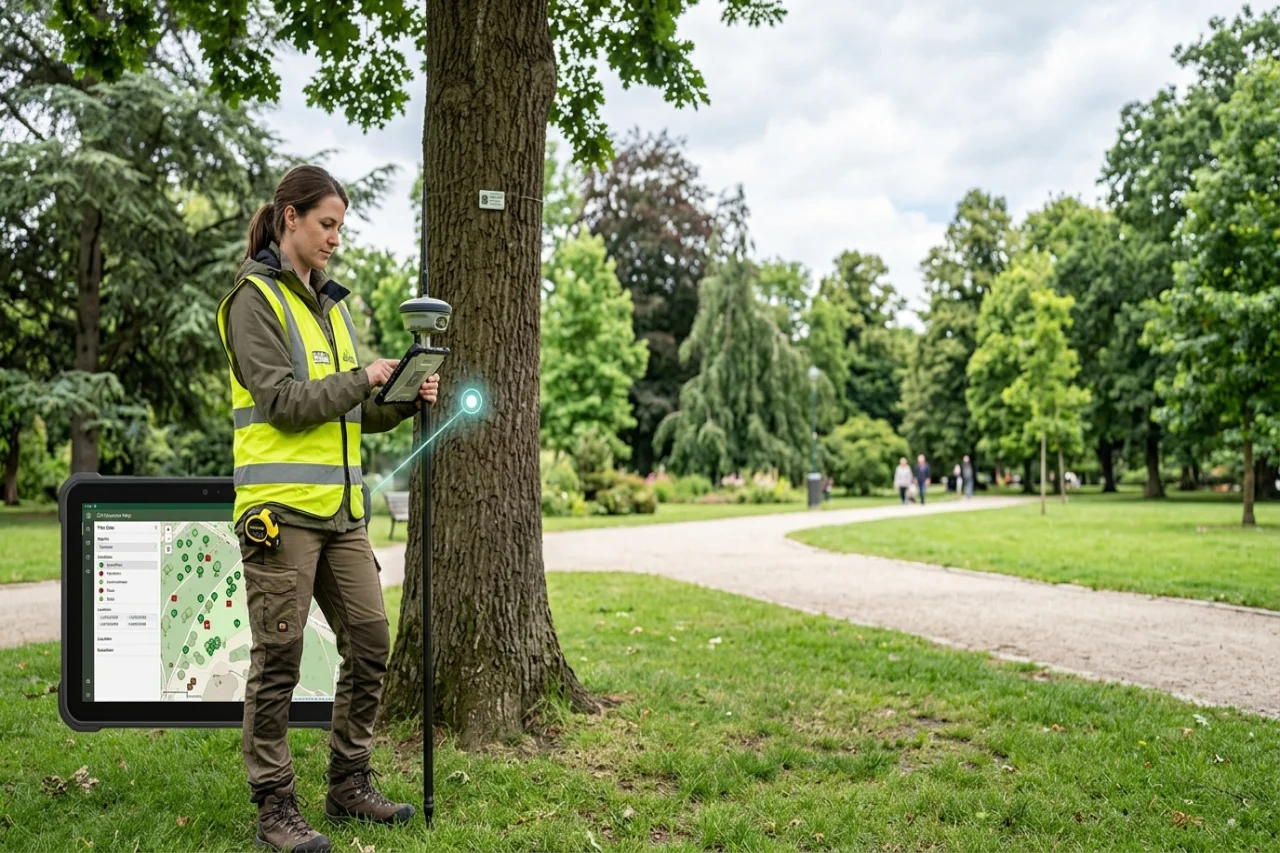
A tree record is only useful when its location is reliable
Tree inventories are built to answer practical questions. Which trees are present on a site? What condition are they in? Which ones require inspection, pruning, or removal? Where are the highest-risk assets located? None of these questions can be answered properly when location data is vague or inaccurate. Accurate mapping helps arborists, municipalities, and property managers connect individual tree records with their physical locations, while resources on tree inventory software can provide additional context on how digital mapping fits into broader tree inventory and management practices.
The quality of a tree inventory depends on more than the amount of information collected. A database may contain species, diameter, health condition, and maintenance history, but those details lose much of their value if teams cannot confidently identify the correct tree in the field. Accurate geolocation turns a static list into a working operational map.
Traditional location descriptions create ambiguity
Older tree inventories often depend on handwritten notes, paper maps, or general descriptions such as “near the north entrance” or “behind the second building.” These descriptions may be understandable to the person who created the record, but they become less reliable over time.
Landscapes change. Buildings are renovated, signs are moved, paths are redesigned, and staff members leave. A description that once seemed clear may become difficult to interpret several years later. Large properties can also contain multiple trees of the same species and similar size, making visual identification unreliable.
Geolocation data reduces this ambiguity by assigning each tree a consistent position. Instead of depending on memory or changing landmarks, field teams can work from coordinates and digital maps.
Accurate coordinates improve field efficiency
Tree care teams often spend a surprising amount of time locating assets before they can begin actual work. This becomes a major issue on campuses, municipal land, large residential developments, parks and commercial properties.
When tree positions are accurate, crews can navigate directly to the correct asset. They do not need to search the site, contact the office for clarification, or risk inspecting the wrong tree. This improves productivity and makes daily schedules more predictable.
Accurate mapping also helps managers organize work geographically. Jobs can be grouped by area, reducing unnecessary travel across large sites. For organizations managing thousands of trees, even small improvements in navigation can save substantial time.
Location data connects inspections with the right asset
Tree inventories are often updated repeatedly over many years. An arborist may inspect a tree, record a defect, and recommend another assessment at a later date. For this history to remain useful, each update must be connected to the correct asset.
Location errors can result in records being assigned to the wrong tree. This can create confusion about condition, previous work, and current risk. In the worst cases, a hazardous tree may be overlooked because its inspection history was attached to a nearby asset.
Precise geolocation helps create a reliable identity for each tree. Species, dimensions and photographs remain important, but coordinates add a stable reference point that supports accurate long-term recordkeeping.
Better maps support risk management
Tree risk is closely connected to location. A declining tree beside an empty field does not present the same exposure as a similar tree beside a road, playground, building, or power line. Inventory data becomes more valuable when tree condition can be considered alongside surrounding infrastructure.
Digital mapping allows managers to see where high-risk trees are concentrated. They can identify assets near pedestrian routes, parking areas, public facilities or other sensitive locations. This supports better prioritization when budgets and crew capacity are limited.
Instead of treating every maintenance recommendation equally, organizations can consider both tree condition and potential impact. That creates a more practical and defensible approach to risk management.
Geolocation improves emergency response
Storms and severe weather can create urgent tree-related problems across a wide area. Fallen limbs, blocked roads, and unstable trees may need to be assessed quickly. During these events, location accuracy becomes especially important.
A mapped inventory helps teams understand what trees are present in the affected area and whether there is an existing history of defects or previous work. Managers can dispatch crews with clearer instructions and prioritize locations based on public safety or infrastructure impact.
Field updates can also be connected to the mapped asset, helping the office maintain an accurate view of what has been inspected, secured or scheduled for further work.
Mobile data collection makes inventories more reliable
The value of geolocation increases when field teams can collect and update data directly on-site. Mobile devices allow arborists to confirm positions, add photographs, record changes in condition, and document completed work while standing beside the tree.
This reduces the risk of information being lost or entered later from memory. It also helps maintain consistency between office records and field conditions.
When location data, inspection details and work history are captured in the same workflow, the inventory becomes easier to trust. Each update strengthens the record instead of creating another disconnected file.
Mapping supports better maintenance planning
Tree maintenance is rarely a one-time activity. Many assets require inspections, pruning, treatment or monitoring over a long period. Accurate geolocation helps organizations plan this work more efficiently.
Managers can view upcoming tasks by location, group nearby work and balance crew assignments across different areas. They can also analyze patterns, such as repeated failures in one section of a property or a concentration of aging trees near critical infrastructure.
This geographical context is difficult to see in a spreadsheet. A map makes relationships between trees, conditions and maintenance needs easier to understand.
Location accuracy matters for reporting and accountability
Municipalities, commercial property owners and institutions may need to report on tree populations, maintenance activity or risk management. Accurate location data supports clearer reporting because each record can be traced to a specific asset.
This is particularly important when multiple contractors, departments or staff members contribute to the same inventory. A shared geographical reference reduces duplication and helps everyone work from the same information.
It also improves accountability. Managers can verify where work was completed, which trees were inspected and whether recommendations were addressed.
Geolocation data still needs regular validation
Digital coordinates are more reliable than informal descriptions, but they are not automatically perfect. GPS accuracy can vary depending on the device, surrounding buildings, tree canopy, and collection method. Records may also be created incorrectly or moved during data imports.
For that reason, location data should be reviewed as part of normal inventory maintenance. Field teams should confirm positions when they inspect trees and correct records that do not match site conditions.
Photographs, asset identifiers and detailed notes can provide additional verification. The strongest inventories use several forms of identification rather than depending on coordinates alone.
From simple records to location intelligence
The real value of geolocation is not limited to finding individual trees. When accurate location data is combined with condition, species, age and maintenance history, organizations can identify broader patterns.
They can compare tree health across different areas, locate gaps in canopy coverage, plan replacement programs and understand how tree assets relate to buildings, roads and public spaces. The inventory becomes a source of location intelligence rather than a simple asset register.
This supports better decisions about budgets, staffing and long-term landscape planning.
Conclusion
A tree inventory is only as dependable as its ability to connect information with the correct physical asset. Without accurate location data, inspections can be misapplied, crews can waste time, and important risks can be missed.
Accurate tree inventories help organizations create a clearer link between individual records and real-world locations. By combining geolocation with inspection data, photographs, and maintenance history, arborists and property managers can build a more reliable foundation for fieldwork, risk planning, and long-term tree management.
Accurate coordinates may seem like a small technical detail, but they determine whether an inventory functions as a useful operational system or remains little more than a list.
Comments
Comments are available to signed-in users and are moderated to keep the discussion useful and respectful. Spam, automated submissions, and low-value promotional comments are removed. Outbound links may be approved when they are relevant and genuinely helpful to readers, but they are displayed as plain text rather than clickable hyperlinks.
No comments have been published yet.
Please sign in to submit a comment.